Nigeria Operational Wards v3.0 Now Available
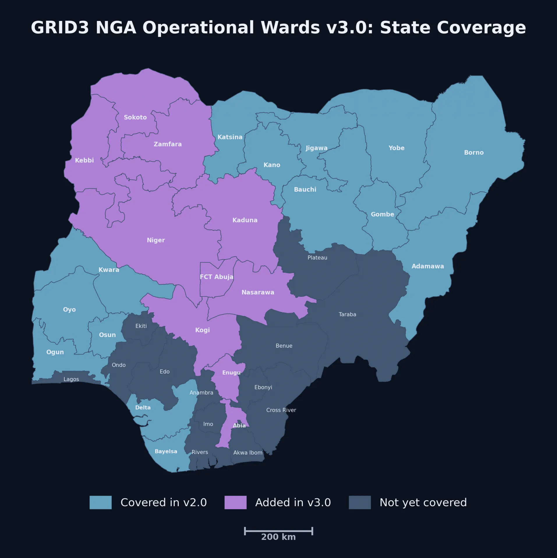
CIESIN, in collaboration with GRID3, has released GRID3 NGA - Operational Wards v3.0, a new geospatial dataset that provides operational ward boundaries for 24 states across Nigeria. The release expands coverage with 10 newly added states while updating previously released boundaries to improve spatial consistency across the dataset. Version 3.0 also improves the alignment of ward boundaries with roads, rivers, coastlines, and settlement extents, and includes refinements where ward boundaries intersect hamlets. Additional boundary refinements, harmonized ward names, and quality improvements strengthen continuity across neighboring states, making the dataset more consistent and easier to use for mapping, spatial analysis, and other geospatial applications.
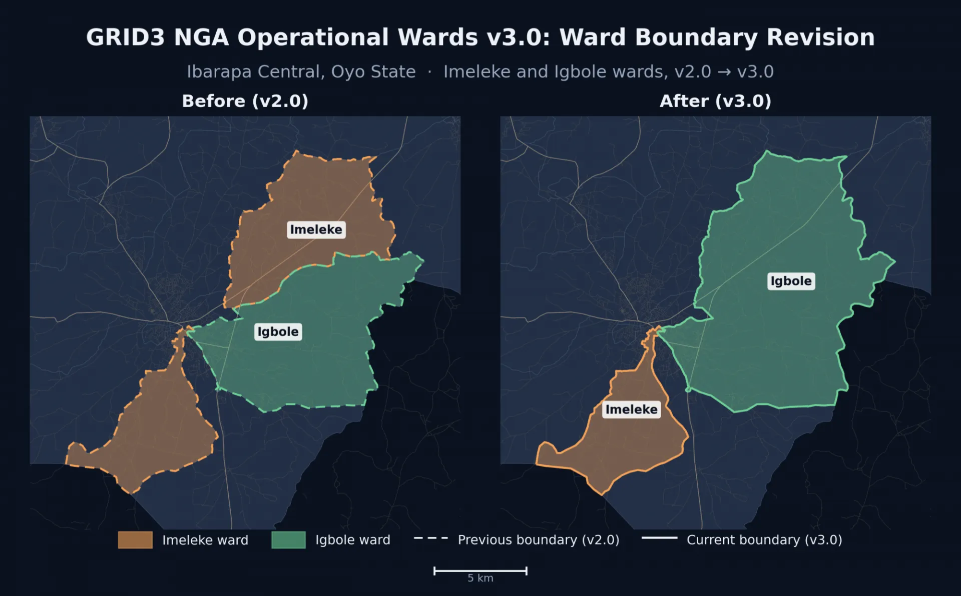
Operational ward boundaries provide a critical geographic foundation for planning and coordinating activities at the local level. Designed for operational use, the dataset supports microplanning, resource allocation, service delivery, and health campaigns that rely on accurate subnational geographic information. By providing a consistent representation of ward boundaries across multiple states, the dataset helps organizations work with a common geographic framework for mapping, analysis, and coordination.
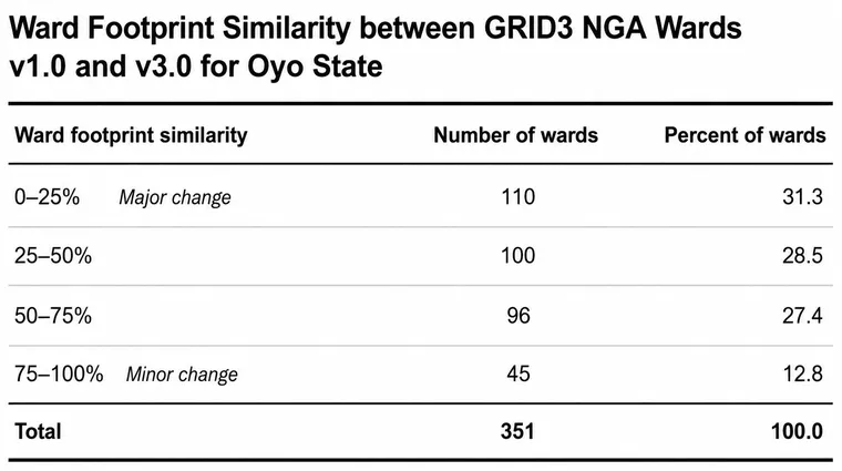
The dataset is available in OGC GeoPackage format under a CC BY-SA 4.0 license. Download the data here.
Portions of this news blurb were edited with the assistance of AI tools to improve clarity and readability. All content was reviewed and validated by the authors.