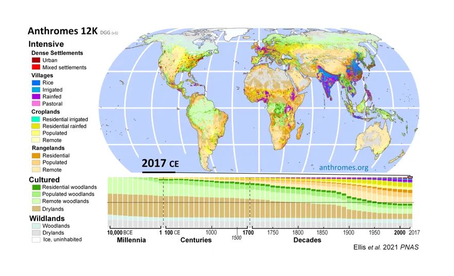
Anthropogenic biomes, or Anthromes, is a global data set developed by Dr. Erle Ellis at the Anthroecology Lab of the University of Maryland Baltimore Campus. It uses a mix of remote sensing, historic population distribution, and other data inputs to characterize human land uses across time. The Anthromes 12K Geographic Projection (10,000 BCE to 2015 CE) represents 12,000 years of gridded anthropogenic biomes for 75 time steps between 10,000 BCE and 2017 CE. CIESIN converted the entire Anthromes 12K collection from Discrete Global Grid (DGG) format to grids in geographic projection. While DGG is great because its grids are equal area, they tend to be used only in certain fields, such as biodiversity conversation. The converted grids will greatly assist those who wish to use the data in conjunction with other global data sets in geographic projection.
A globally consistent land use data set has many uses, and CIESIN has used past versions of the Anthropogenic Biomes data for projects with the World Bank and USAID (see Groundswell reports and "Data integration for climate vulnerability mapping in West Africa").
For more on the Anthromes 12K product, see this article in the Proceedings of the National Academy of Science: https://doi.org/10.1073/pnas.2023483118
To download the data, visit: https://doi.org/10.7910/DVN/MWMWPH