CIESIN's experts in geographic information science (GISci) provide support to Columbia Faculty and Researchers in spatial data services. CIESIN works with CU partners to acquire, integrate, and analyze spatial data to suit research or project needs. CIESIN has also worked extensively in spatial data visualization and delivery via interactive map viewers, open APIs, and dashboards. No matter what the stage of your work - whether its proposal development, geospatial processing in the cloud or on our servers, or service development using open-source or COTS solutions - CIESIN can assist you.
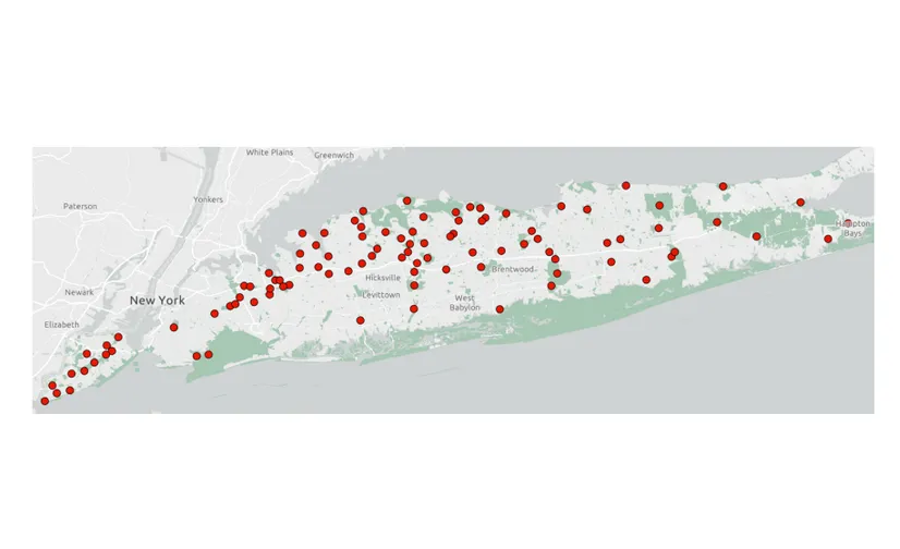
In a recent example of our work, CIESIN assisted Columbia’s Eco-Epidemiology Lab in designing a spatially representative household survey in portions of New York and Massachusetts to gauge human exposure to ticks based on nearby sampling sites (see map).
For other examples and more information, visit our Spatial Data Services section of the GIS Service Center home page.